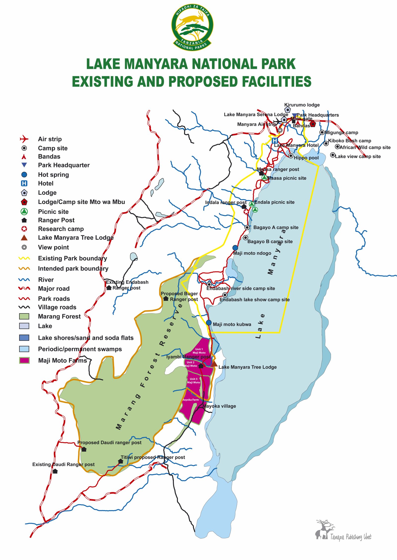
Manyara National Park
Lake Manyara National Park delivered its name from a plant called Euphorbia tirucalli, known as Emanyara in Maasai language. The Maasai are using this plant to
protect their bomas (hedge). The Park was gazette as a National park in 1960 and was declared as Man and Biosphere Reserve in 1981. The park has an area of 648.7 km2 (402 sq miles) of which 262.7 km2 (163 sq miles) is covered by lake and 386 km2 (240 sq miles) is dry land.
The rainfall pattern of the park is bi-modal with short rains starting from November to December and long rains from February to May, dry season is from late June \ to October, annual mean temperature is 26.50C, average temperature 11.340C and relative humidity ranges from 45%-85%.
From the entrance gate, the road winds through an expanse of lush jungle-like groundwater forest where hundred-strong baboon troops lounge nonchalantly along the roadside; the blue monkeys scamper nimbly between the ancient mahogany trees; dainty bushbuck tread warily through the shadows, and the outsized forest hornbills honk cacophonously in the high canopy.
In contrast with the intimacy of the forest, is the grassy floodplain and its expansive views eastward, across the alkaline lake, to the jagged blue volcanic peaks that rise from the endless Maasai Steppes. Large buffalo, wildebeest and zebra herds congregate on these grassy plains, and so do the giraffes – some so dark in coloration that they appear to be black from a distance.
Our Email
info@togoodsafaritz.com
Contact Us
+255 753 569 914